
Navigation, the importance of staying found
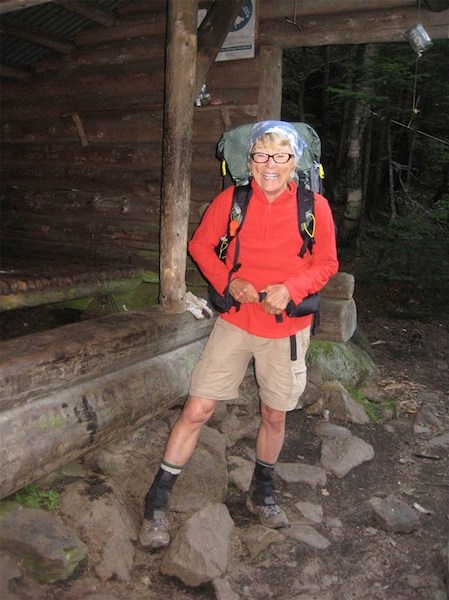
Geraldine Largay was a retired air force nurse who had hiked long trails near her home in Tennessee. In 2013, she’d set out to hike the length of the epic 2,168-mile Appalachian trail. Known to her friends as Gerry, she’d taken a trail name like many other hikers, hers, was “Inchworm”. Largay had already walked more than 1,000 miles of her route by the 22nd July 2013 when she left the trail to relieve herself.
She remained missing for over two years.
Gerry’s body was found on Oct. 14, 2015, less than a kilometre (3,000 feet) from the Appalachian Trail, investigators read through her journal to piece together what happened. The last passage was dated 18th August.
Largay survived for 26 days after disappearing, she wrote desperate journal entries and text messages. In a notebook entry dated 6 August 2013, two weeks after she lost her way, Largay made a desperate plea: “When you find my body, please call my husband George and my daughter Kerry,” she wrote. “It will be the greatest kindness for them to know that I am dead and where you found me – no matter how many years from now. Please find it in your heart to mail the contents of this bag to one of them.”
Now, we’re not here to pick holes in Gerry’s actions after she became “Geographically embarrassed.” Though, she did make some obvious mistakes. For example, Gerry’s final camp saw her having pitched her tent under a tree so that it was harder to spot from the air. Largay had a SPOT locator beacon, sadly, in her husband’s car.
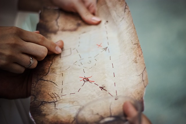
There is a simple truism, that the best way to get out of a survival situation is to not get into one. So how could Gerry have helped herself to stay found?
Coarse Navigation: This is simply having an awareness of where we are in relation to the wider world. This could be something as simple as knowing that there’s a main road a few miles in one given direction, and a significant river a couple of miles in another direction. Neither of these features is something that we could cross without noticing. So we have some confidence inspiring knowledge that we know where we are roughly. Becoming lost can be obviously very stressful, which can lead to some very rash or poor decision making. Having that little nugget of confidence inspiring knowledge, that we’re not massively lost, we’re just a bit… Misplaced, can make that little bit of difference. It also gives us a simple framework to start getting found again.
Looking Back the way we came. In this age of solidly paved footpaths in the wilderness, blazing, or the act or cutting marks in trees is no longer acceptable. But it was once a common practice for wilderness travellers. However, having a look back at the way we’ve just come from, especially after changing directions, or a fork in the path, is also a much underrated tool for getting found again.
Taking a Compass Bearing may have been the simplest and safest way for Gerry to get back onto the trail after her comfort break. Gerry could have used a map and compass to establish some simple coarse navigation frameworks. Gerry had spent the night at the Poplar Ridge lean to. From there the AT follows an undulating course generally eastwards descending towards Orbeton Stream. This can be checked with the compass. Let’s suppose we turned left off of the trail, we’d be heading north for a certain distance, knowing that we’d need to head south to return to the trail.
Gerry’s notebook entries explained that she had spent about two days wandering after a wrong turn across a stream, and that she had tried to find ridges where she could regain some sense of place. One of the other hikers who’d met Gerry earlier in her hike said “She looked spry, happy…” and “She looked like a confident, experienced backpacker.” However, one of gerry’s close friends told wardens that she had questionable skills with a compass.
The importance of having basic navigation skills cannot be overstated. Not only with a view to preventing mishaps like Largay’s, and the worry it caused her family. But having basic nav’ skills, including the ability to read a map opens up so many possibilities. The map not only offers us a glimpse of what we might find exploring a particular area. Planning places to camp, deciding where to walk, or where to paddle. Maps can also be treasured mementos of trips gone by. Recalling the sweat involved in scrambling up some seemingly interminable mountain scree slope, or the memory of basking in the sun and satisfaction of the climb at the top. Looking through my box of maps at home often brings back fond memories of previous adventures with good friends. It also makes me think I really need to replace a couple of them. (The maps not the friends).
Do I want to be like Gerry? Well yes! By all accounts she was a a warm and gregarious individual. I can only hope that I’ll still be able to go backpacking for a thousand miles when I’m 66, and, to be described as spry and happy!
In the meantime, I’ll be running navigation workshops amongst other skills available at the Bushcraft UK Bushmoot.